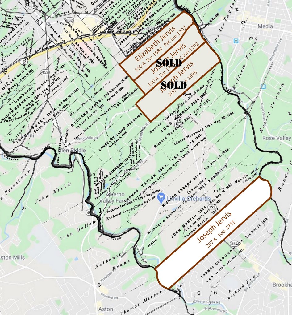
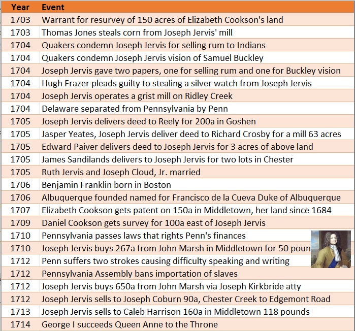
In 1711, Joseph Jervis bought a tract of land from John Marsh.
Joseph had sold his mill land on Ridley Creek, and bought and sold various other parcels over the years.
The tract was 267 acres in Middletown, a short distance south of his previous lands and Elizabeth’s land. The price was £50.
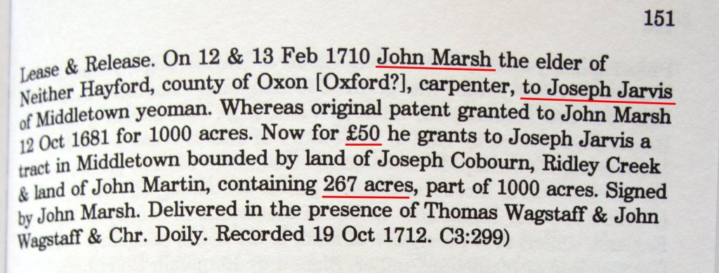
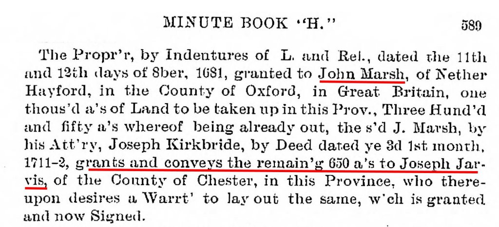
John Marsh was a carpenter from Nether Hayford in Oxford County, England. He had purchased 1,000 acres from William Penn in England in 1681. This made him a “first purchaser”, those original investors who committed to buy land before the province was settled.
Marsh never came to America. He sold his interest in the lands through his attorney Joseph Kirkbride who lived in Pennsylvania.
The 267 acre tract that Joseph bought in 1711 was part of John Marsh’s 1,000 acre original purchase. The tract had already been surveyed and warranted.
And then he sold it
In 1713, two years after Joseph bought the land, he sold it. There were two sales, one to Joseph Cobourn of 104 acres for £78, and another to Caleb Harrison of 160 acres for £118.
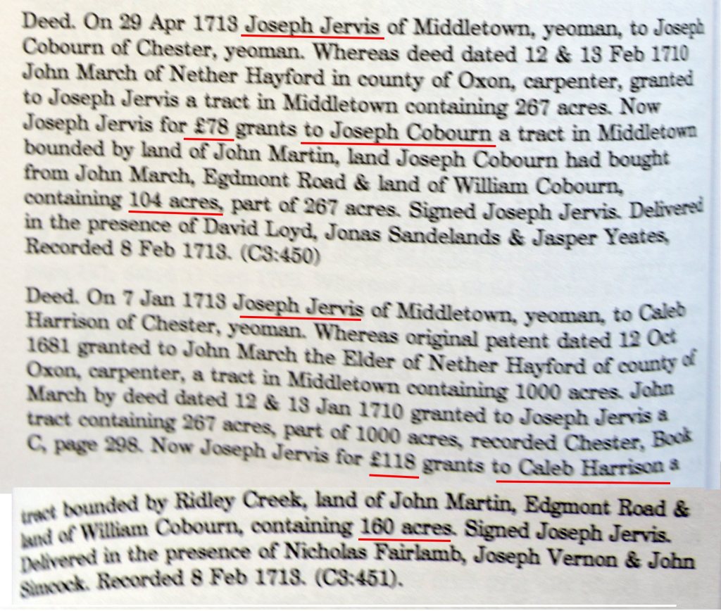

Joseph had paid £50 in 1711 and sold for £196 in 1713. A tidy profit.
I think Joseph was more an entrepreneur than a farmer.
And then he bought more
John Marsh still held 650 acres of his original 1,000 acres that hadn’t been surveyed or warranted. In March 1712, Joseph bought the right to those 650 acres.
At the property commissioners’ meeting December 22, 1714, the warrant was granted, and a survey ordered.
This would foretell a big change in Jervis world, for Joseph would ask for land 35 miles to the west, and eventually move to settle there.
Nibbles Extra Credit
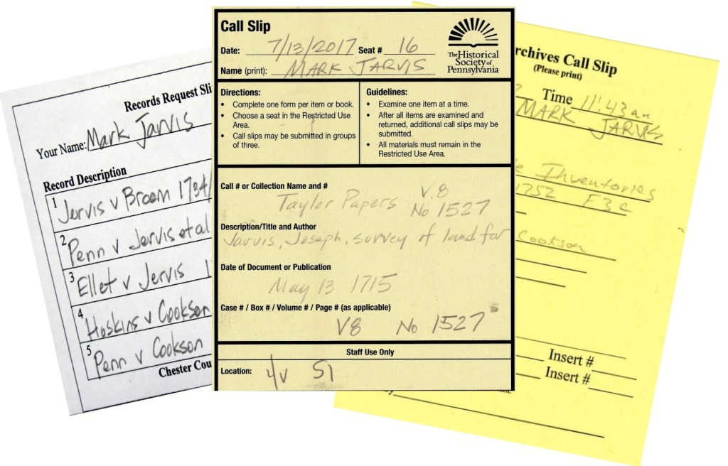
When researching original artifacts and documents, many archives require you to submit a document request “call slip”, listing the documents you’d like to review. At certain time intervals, the librarians or archivists bring the artifacts to your assigned desk or table.
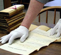
You might have to wear cloth gloves, and place the documents on a foam pad. The foam pad protects the spine of a book from separating.
In other places, the requirements are less restrictive. You search the index card file on your own, then go find the artifacts yourself.
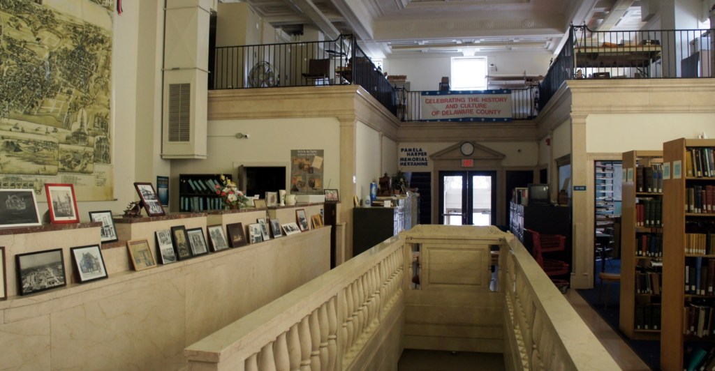
Such was the case at the Delaware County Historical Society. It’s the kind of old-timey place I love. A volunteer worker or two, and musty and dusty shelves and cabinets. A researcher’s delight.
It Makes Me Tingle
There. I said it again. Now and then, you find a citation or document or artifact that affects you physically. It makes you tingle.
Such was the case at the Delaware County Historical Society, when I retrieved a file folder from the bottom drawer of a file cabinet. It was indexed as Item 4629, a deed for Joseph Jarvis.

It was a parchment packet, folded and tied. On the outside was “Jarvis his writings”. That means “Jarvis his copy”. I tingled.
As I began to unfold it, signatures and wax seals and margin notes were revealed, and then the deed document. It was Joseph’s copy of the deed from John Marsh for the 267 acre parcel of land, dated February 13, 1711.
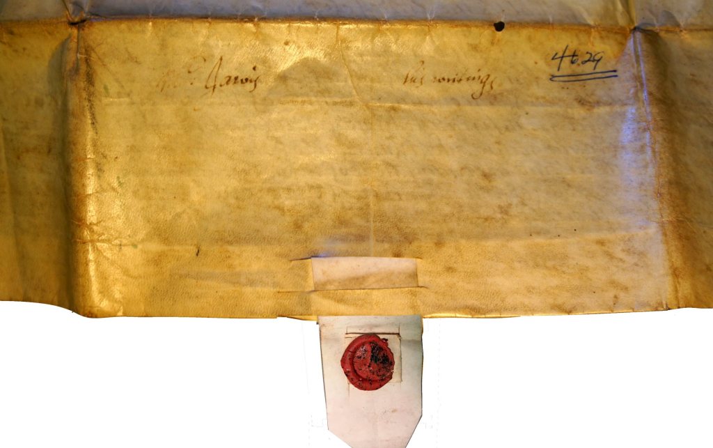


To know that this document was owned by our grandfather Joseph Jervis makes it very special. He was “in the room when it happened”.
And I got to handle it and photograph it and read it. I felt a connection to the people who wrote and signed it so long ago.
Nibbles Extra Credit
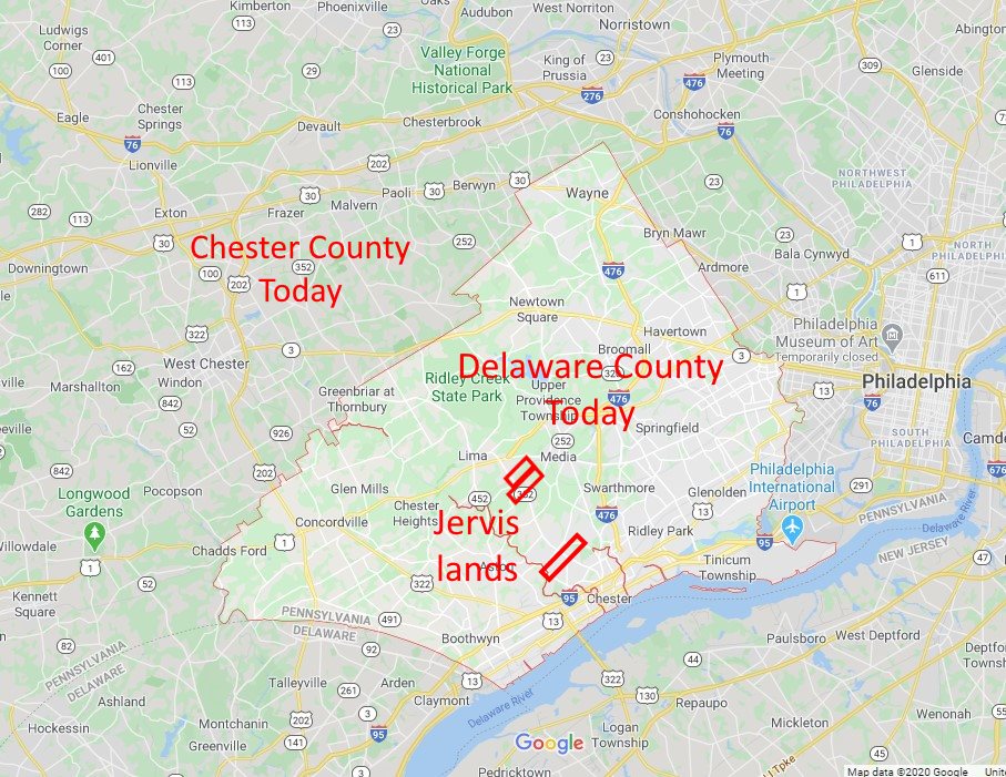
Why was I researching at the Delaware County Historical Society? Why not Chester County?
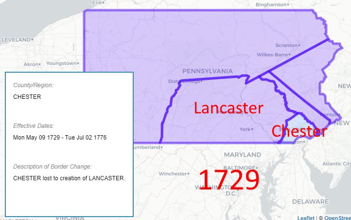
William Penn set up three original counties in Pennsylvania – Chester, Philadelphia, and Bucks.
The counties were bounded on the south and east by the Delaware River. But they didn’t have formal north or west boundaries. They stretched far across the province.

As populations increased and settlement occurred, the counties were sub-divided and new counties created.
Lancaster County was carved out of Chester County in 1729, leaving Chester County much smaller.
Delaware County was created from the southeast part of Chester County in 1789. The lands of Elizabeth and Joseph Jervis are today in Delaware County.
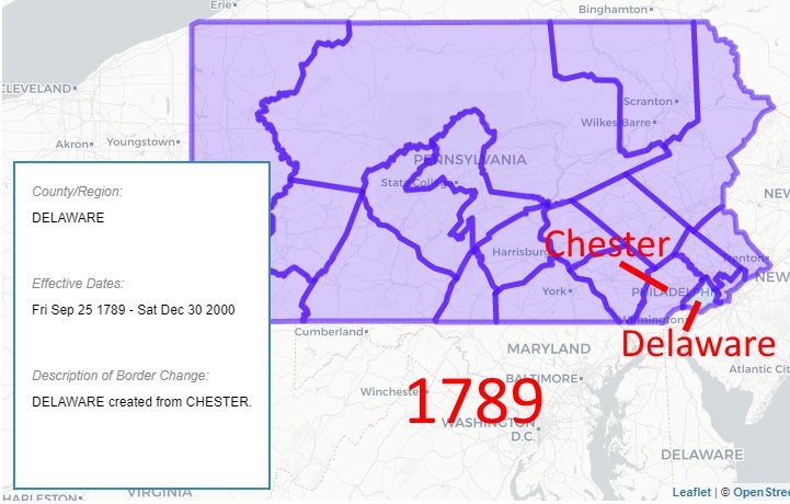
County government records before 1789 are archived in Chester County, after 1789 in Delaware County.
Here’s a link to an interactive map where you can see the evolution of county maps in Pennsylvania.
Atlas of Historical County Boundaries
Timeline
Sources
- Image – For sale sign on farm – collation of Wikipedia images
- Map – Joseph Jervis – Middletown 267 acres – collation of various maps – Mark Jarvis
- Deed – Joseph Jarvis from John Marsh – Middletown 267 acres – 1711 Item 4629 – Delaware County Historical Society, Chester, PA
- Record request forms and photos – Mark Jarvis – July 2017
- Atlas of Historical County Boundaries – The Newberry Library – https://publications.newberry.org/ahcbp/map/map.html#PA
- Map of Delaware County, Pennsylvania – Google Maps
