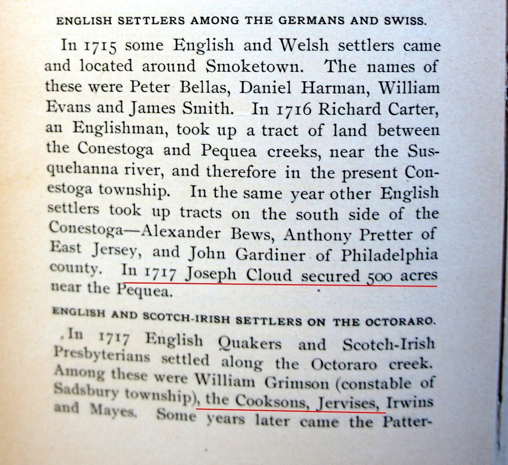
In 1713, the Clouds, Cooksons, and Jervises had decided to move west.
I know a man together with two or three more, that have happened upon a piece of Land of some Hundred Acres, that is all cleare, without Trees, Bushes, stumps, that may be Plowed without let, the farther a man goes in the Country the more such Land they find.
Excerpts from Letter from Thomas Paschall to friend in Chippenham England – 1683
Chester County extended far to the west and north of Middletown. It was still unsettled. Some of that land was more desirable for farming then the creeks and valleys and woods around Middletown.
Pequea and Conestoga
The families were interested in lands near the head of Pequea Creek, along an old trail toward the Conestoga trading post on the Susquehanna River.

The Conestoga trading post had been founded by several French Canadian trappers and Indian traders, among them Peter Bezaillion and James LeTort.
The old trail from Philadelphia to Conestoga at the Susquehanna River was called Bezaillion’s Road or Peter’s Road.
It was along this road that Jarvis and Cloud and Cookson requested land from the proprietors.
Ed. Note: Pequea is (pronounced peck-way).
Why move?
We don’t know their motivation, but perhaps Joseph needed a bit of a fresh start. By 1714, he didn’t have a large or desirable piece of land in Middletown. And he had just acquired rights to 650 acres from John Marsh.
We don’t know about the Cooksons or Clouds. They, too, had their run-ins in court and some land disputes. But we just don’t know what their reasons were.
I wish we had their letters or diaries so we might get an insight.
New warrants
In any case, Jervis, Cookson, and Cloud all applied for warrants and surveys for land at the head of Pequea Creek.

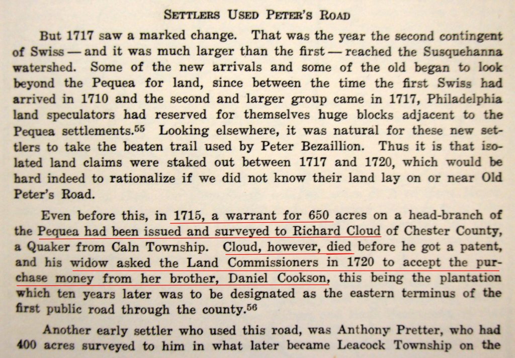
Richard Cloud / Daniel Cookson warrant
Richard Cloud was first to get a warrant and survey, for 650 acres. But he died unexpectedly in 1717. His wife Hannah asked the land commissioners to allow her brother Daniel Cookson to get the warrant.
Joseph Jervis warrant
Here’s Joseph Jervis’ survey for 460 acres, surveyed by John Taylor May 13, 1715. It was part of the 650 acre rights that Joseph had acquired from John Marsh in 1713.
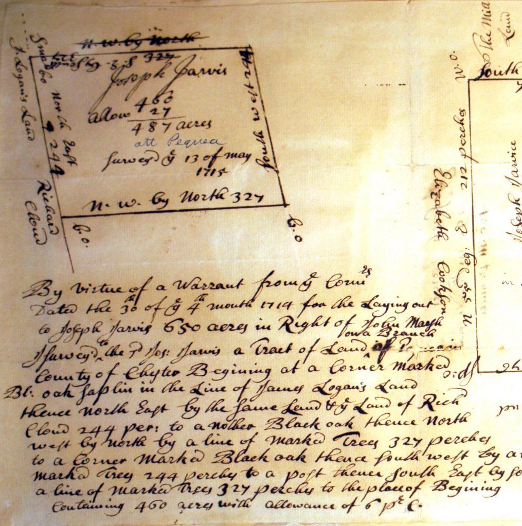
Here’s how the two warrants laid out.
- Joseph Jervis – 460 acres along a run of Pequea Creek
- Richard Cloud – to Daniel Cookson – east branch of Pequea Creek

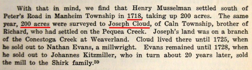
Joseph and Ruth Cloud
Joseph and Ruth Cloud got a warrant a few miles to the northwest.
Earliest settlers
In 1709, several hundred Mennonites from Switzerland and Germany settled around Conestoga. It was the only significant settlement of Europeans west of Chester.
Our three families were among the dozen or so settlers between Conestoga and the settled townships of Chester County.
A long stay
Joseph Jervis was in his mid-40s when he moved to Pequea Creek. He had a growing family.
His siblings and in-laws were nearby. His mother Elizabeth still lived in Middletown, but she would soon move to live with daughter Ruth Cloud.
Joseph would live here for the rest of his life, some 30 years. We’ll look at his life and wives and children in the next few stories.

Timeline

Sources
- Book mention of early settlers on Pequea and Octoraro Creeks – A Brief History of Lancaster County – Israel Smith Clare – 1892
- Lands at the Head of Pequea – Survey List – John Taylor – 1715 – Historical Society of Pennsylvania – Philadelphia, PA
- Survey – Joseph Jervis – 460 acres in Pequea Creek – 1715 – Historical Society of Pennsylvania – Philadelphia, PA
- Richard Cloud warrant assigned to Daniel Cookson – Paper – Historical Papers of Lancaster County Historical Society – Volume XLIII – 1939 – Bazillions Road
- Tax assessment and census lists – Assessment Lists and Other Manuscript Documents of Lancaster County Prior to 1729 – Lancaster County Historical Society – Lancaster, PA – 1916
- Maps – collation of base modern maps like Google maps and overlaid layers of drawings or graphics.
- Joseph Cloud warrant information – Paper – Historical Papers of Lancaster County Historical Society – Volume XLIII – 1939

Fabulous! Thank you so much!
LikeLike
You’re welcome, Matt. Glad it was helpful.
LikeLike