During the 1760s, the Jervis families had moved to Maryland.
Whatever their reasons, they did as their two previous generations had done. They moved west. This time, southwest to Maryland.

Maryland
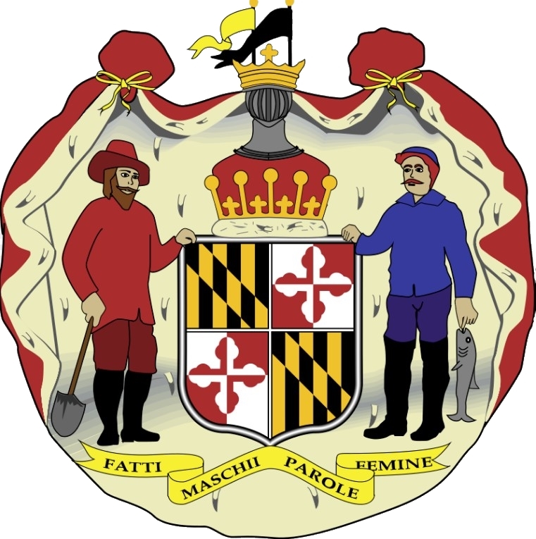
Maryland was established fifty years earlier than Pennsylvania. In 1632, King Charles I granted the territory of Maryland to Cecil Calvert, 2nd Lord Baltimore. Charles I named the province Terra Mariae (Mary Land) after his wife Henrietta Maria of France.
Maryland was granted to provide religious toleration for England’s Roman Catholic minority. However, Catholics made up only 10% of the early population of Maryland.
1770 Boston Massacre

The decade of the 1770s started in America with a bang. Literally.
On March 5, 1770, in Boston, a crowd gathered around some British soldiers. The crowd began threatening, and throwing rocks at them. The soldiers fired into the crowd, hitting eleven people. Five died. As the word of the “Boston Massacre” spread, colonists were outraged.
Dr. John Archer
Some of the earliest Jervis citations in Maryland are found in the medical ledgers of Dr. John Archer.
Dr. Archer graduated from the School of Medicine in Philadelphia in 1768, the first medical graduating class in America. Since he stood at the first of the list alphabetically, he is popularly referred to as the first graduate of medicine in America.
He founded his practice in 1768 at his home in Maryland, near where the Jervis families lived.

Dr. Archer treated Joshua Jervis in 1772. We find John’s family in the ledger in 1773, and James in 1779.
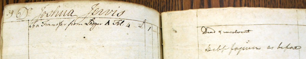


The “Dr” by the patient’s name doesn’t mean doctor. It’s that accountant’s abbreviation for Debit, or a charge for a medical treatment. The right-facing page is “Cr”, or Credit, recording when the patient pays.
Notice that the credit page says that the debt was forgiven for each of the Jervis patients. Many of the patients in Dr. Archer’s ledger were graced with “Debt forgiven”.
1773 Boston Tea Party
Parliament passed the Tea Act of 1773 to protect the interests of the British East India Company, trying to force the colonists to buy British tea with tariffs instead of smuggled Dutch tea.

On December 16, 1773, a group of men, led by Samuel Adams and dressed to evoke the appearance of indigenous people, boarded the ships of the British East India Company and dumped £10,000 worth of tea from their holds (approximately £636,000 in 2008) into Boston Harbor. Decades later, this event became known as the Boston Tea Party
Harford County
James Jervis and his siblings lived in northeast Maryland, north of the Tidewater region. The land was less expensive, but it was distant from the trading ports and waterborne transportation.
This was the frontier of the province. A few years after their arrival, in 1774, Harford County was created from the eastern portion of Baltimore County.
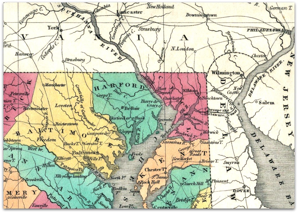
The county was named for Henry Harford, illegitimate son of Frederick Calvert, 6th Lord Baltimore. Henry inherited his father’s estate in 1771, including Maryland. He was 13 years old.
He was the last proprietary owner of Maryland, as the American Revolution would usurp his ownership.
Hundreds
Harford County was divided into “hundreds”, like we saw in England. Some say a hundred was an area of 100 families, or an area capable of raising 100 men for military duty.
Hundreds were the political division for taxation lists, censuses, militias, etc.
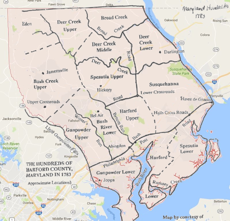
James, Solomon, and Catherine Jervis lived in the Bush River Lower Hundred, John, and Joshua in Upper Spesutia, William in Susquehanna. Caleb moved to Kent County, Delaware.
James (6G) and Elizabeth Jervis
James Jervis married Elizabeth around 1771. We don’t know Elizabeth’s family name. She was likely from Maryland around where James was living.

James’ mother Esther (7G) is living in the household, as is James’ 11-year-old son William (5G).
In 1772, James and Elizabeth have their first child, Joseph. Joseph is probably named after his grandfather Joseph (7G), James’ father.
In 1774, another son Thomas is born. And by 1776, daughter Mary is born.

By 1774, James Jervis’ family was living in a stone house in Scott’s Old Fields in Bush River Lower Hundred.
James’ mother Esther is living with his family.
And James’ brother Joshua and family are living nearby, perhaps in the same house.

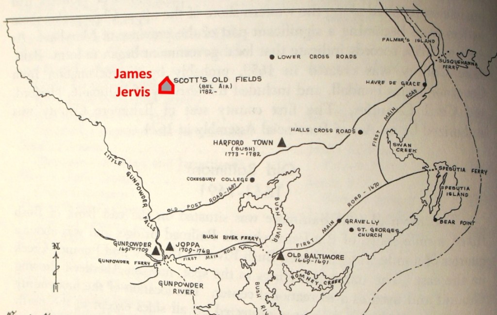
Aquilla Scott’s family had held and farmed the land since the 1680s. After fifty or sixty years of cultivation by eighteenth century methods, the land was played out. So it came to be called “Old Fields.” The old fields would be abandoned for newer fields.
Thus the Scotts rented or sold some parts of the Old Fields, and James and Elizabeth Jervis rented and lived in a stone house there.
1774 First Continental Congress
In response to the Boston Tea Party, the British Navy began a blockade of Boston Harbor and Parliament passed the punitive Intolerable Acts.
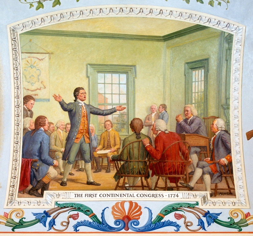
In September 1774, representatives from the colonies gathered at the First Continental Congress in Philadelphia.
The Congress petitioned the King for redress of their grievances and repeal of the Intolerable Acts. The petition had no effect.
The Congress called for a boycott of all British goods beginning in December 1774.
Nibbles Extra Credit – Mason Dixon Line
Maryland Pennsylvania boundary dispute
William Penn’s grant of Pennsylvania’s defined the southern border as identical to Maryland’s northern border, the 40th parallel. That was a big mistake, since the 40th parallel runs north of Philadelphia. Philadelphia would have been in Maryland. It caused a big dispute.

The boundary dispute was carried on by the Calvert and Penn families. It lasted almost a century, with border clashes and even a “war” between the two states.
Mason-Dixon Line
The boundary dispute was finally settled by the king, with final negotiations lasting until 1760. A contract was signed in 1763 by the grandsons of William Penn and Cecilius Calvert.
The king granted Pennsylvania a border line 15 miles south of Philadelphia, but no one knew exactly where that was. Charles Mason and Jeremiah Dixon, two respected English surveyors, were selected to determine the final boundary.
In November 1763, Mason and Dixon began by determining the exact location of Philadelphia. From there, they could locate a point 15 miles south, and that point would be the “Post mark’d West.”
In April 1765, Mason and Dixon began to survey the border to the west, the Mason-Dixon Line. The work was approved in 1768, ending the decades-old dispute.
The North-South slavery boundary
In 1790, the Mason-Dixon Line took on new significance when the Pennsylvania Assembly ended slavery in the state. It became the boundary between slave and free states, especially after the Missouri Compromise in 1820 prohibited slavery north of the Mason-Dixon Line.
Timeline

Sources
- Image of Boston Massacre – The Boston Massacre (1770) as depicted in a coloured engraving by Paul Revere. The Metropolitan Museum of Art, New York, gift of Mrs. Russell Sage, 1910 (accession no. 10.125.103); http://www.metmuseum.org
- Dr. John Archer’s medical ledgers – Maryland State Archives – Annapolis, MD
- Image of Boston Tea Party – W.D. Cooper. Boston Tea Party in The History of North America. London: E. Newberry, 1789. Engraving. Plate opposite p. 58. Rare Book and Special Collections Division, Library of Congress (40)
- Excerpt of Map of Harford County in Maryland – Map of Maryland – 1824 – A. Finley, Philadelphia – University of Maryland Library – College Park, Maryland
- Map overlay of Harford County Hundreds – 1783 – Jon H. Livezey
- Image of stone house – Old Senate House – Kingston, NY – Flickr / Michael Loeffler
- Map of Harford County Seats – Our Harford Heritage – C. Milton Wright
- Tax List – Bush River Lower Hundred – 1774 – Harford County Historical Society – Bel Air, Maryland
- Image of First Continental Congress – US Capitol – The Firsts Continental Congress, 1774 – Allyn Cox – Mural in oil on Canvas 1973-1974
- Coat of Arms of Maryland – Wikipedia – https://en.wikipedia.org/wiki/Seal_of_Maryland
- Map of Maryland and Pennsylvania border dispute – Smithsonian Magazine – https://www.smithsonianmag.com/smart-news/long-violent-border-dispute-between-colonial-maryland-and-pennsylvania-eventually-required-king-step-180963333/
- Mason-Dixon road marker and crown stones – Our Most Famous Border – The Mason-Dixon Line – Kathryn DeVan – Pennsylvania Center for the Book – https://www.pabook.libraries.psu.edu/literary-cultural-heritage-map-pa/feature-articles/our-most-famous-border-mason-dixon-line
