By 1840, the Jarvises had been in Indiana for over fifteen years. Their family was growing. But Harvey and Sarah Jarvis were not permanently settled. They were on the move.
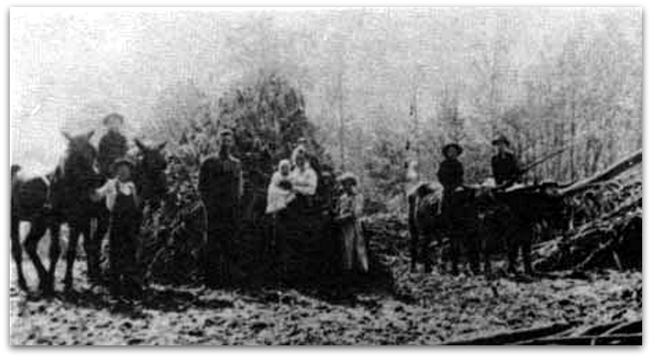
In 1840, Harvey and Sarah Jarvis (4G) were 37 years old. They were living near Versailles, Indiana.

The census listed 6 male children – 1 under age 5, 2 age 5 to 10, and 2 age 10 to 15. Harvey and Sarah had five sons that lived to adulthood. They must have had another son who died young.
Additionally, there’s a reference to a daughter that died in infancy. It’s found in the papers of Violet Toph.
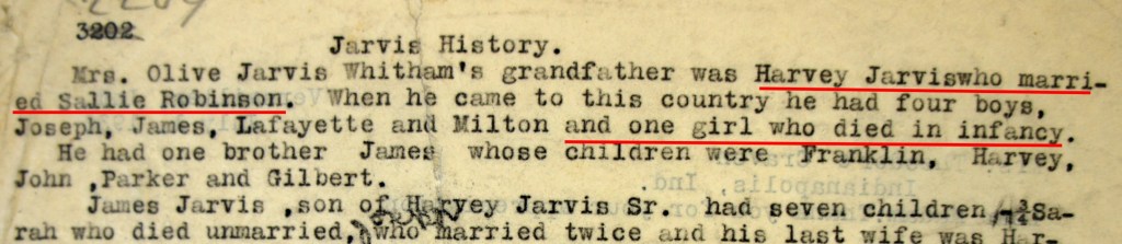
The reference above is from the papers of Violet Toph. Ms. Toph was born in 1878 and spent her life in Ripley County. She compiled her lifetime accumulation of over 3,000 pages of research, interviews, and genealogy in 1930.
So the complete family of Harvey and Sarah Jarvis by 1840 might look like this.
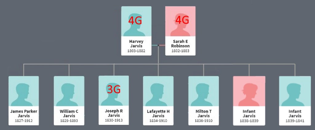
Their third child was our grandfather Joseph R. Jarvis (3G). In 1840 Joseph was age 10.
Middle names and initials
By the way, you’ll notice that many Jarvis citations include their middle initial or name. Our grandfather Joseph shows up often as Joseph R. Jarvis. This wasn’t common in earlier generations. I think it’s because there were so many Jarvises in the area that first names alone weren’t enough to distinguish the person.
So you will see James Parker Jarvis, William C. (Conner) Jarvis, etc. There are many James and William Jarvises.
Harvey’s brother James had a son named Harvey, so some citations refer to our Harvey as Sr. and his nephew Harvey as Jr. Milton T. Jarvis’ brother William had a son Milton S. Jarvis.
I don’t have any citation that tells us what Joseph R. Jarvis’ middle name is. Do you think it’s Robinson? I do.
Where are they living?
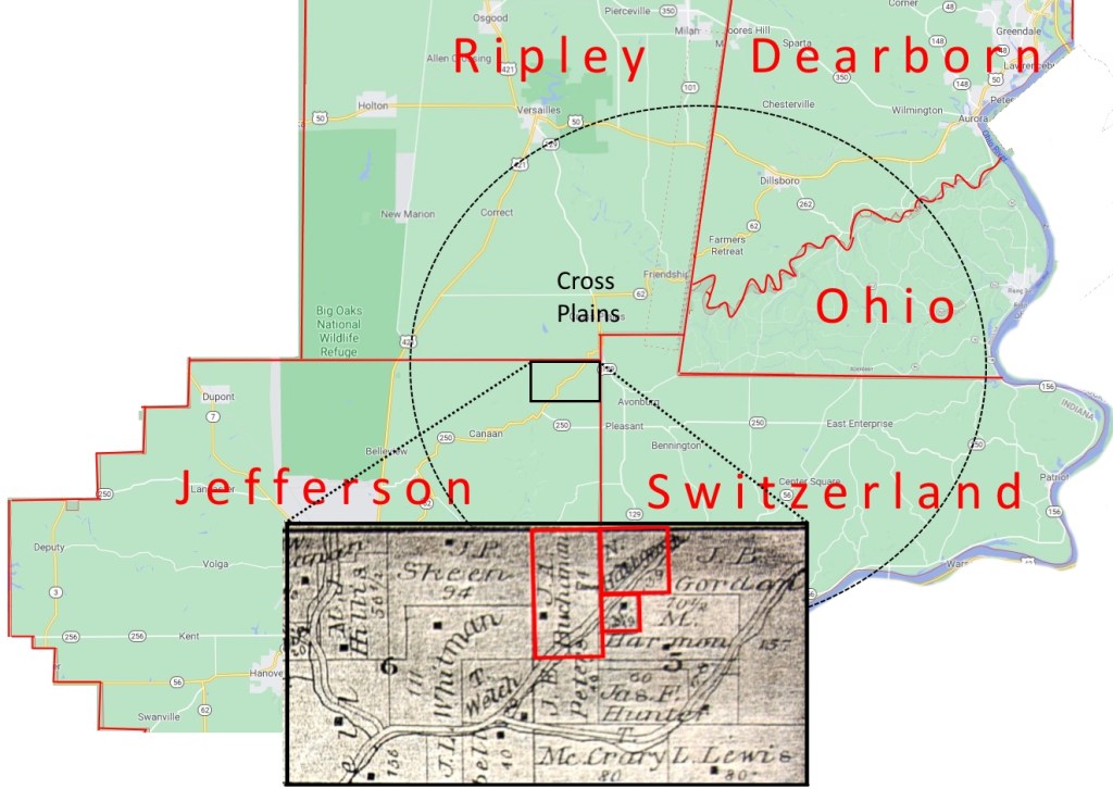
Just like the census in 1830, the 1840 Census doesn’t list the township. We’ll use our earlier strategy to search a land patent map for those names who are listed on the same census page with Harvey Jarvis. The land patents were granted in the 1820s and 1830s, so are close in time to the 1840 Census.
Our search results reinforce the theory that Harvey and Sarah were living a few miles southeast of Versailles. We might further assume that they are living in the same place they did ten years earlier.

A farm in Jefferson County
It seems that Harvey and Sarah had lived near Versailles for over ten years, but they were soon to move.
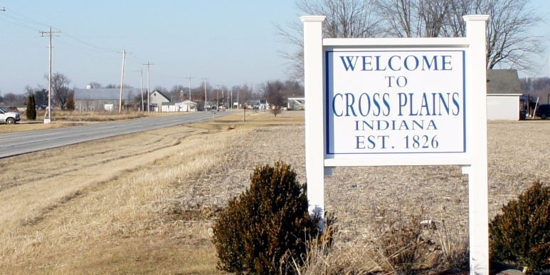
In 1846, Harvey and Sarah bought land from Richard and Nancy May in the northeast corner of Jefferson County. Although the farm was in Jefferson County, it was just three miles from Cross Plains in Ripley County. Madison, the county seat of Jefferson County, was 15 miles away. As we shall see for the Jarvises, “All roads lead to Cross Plains.”
The price was $840. They signed a mortgage indenture to pay the balance within five years.

A difficult farm
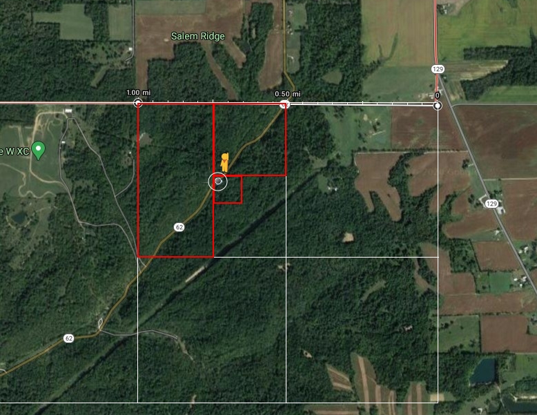
Let’s take a look at the land today. We can view it using Google Maps.
We can see that the land is heavily wooded.
Luckily, Indiana Highway 62 cuts right through the land from southwest to northeast, so we can use Google Street View too.
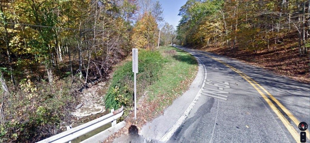
I was surprised at the difficult terrain and woods of Jarvis farms in Chester County, Pennsylvania. But I think this is just as challenging. How could you farm this land? No way.
They paid $840. Maybe Harvey and Sarah wanted a house that was on the land and proximity to Cross Plains for Harvey’s mason work.
Why did they move? Why here? I doubt it was for farming. I wish we could ask them…
Nibbles Extra Credit
Cross Plains, Indiana

By the 1840s, Cross Plains had become the epicenter of the Jarvis’ world. Their extended families all lived within a few miles of Cross Plains. It was the market town, and the town to acquire trade goods and services. If you didn’t need the legal services of the county seat, then Cross Plains was the place to go.
Cross Plains was founded in 1826 and a post office was opened that same year. The original plat had 25 lots, with Lot 16 donated for a house of worship.
James Curry’s Addition was added on January 29, 1827 and added 11 lots. John P. Jarvis Addition added 17 more lots in 1908.
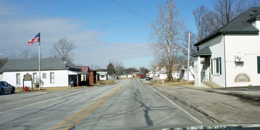
Main Street – looking north 
Main Street – looking south 
Cross Plains – Main Street – looking north
The Jarvises had several businesses in Cross Plains through the years. Here are some of those, listed in the “Brown Township Tales”, by Alan F. Smith.


Jarvis Site Map

Timeline 1840s

Sources
- Image – pioneer family – History of South Central Indiana – USDA Forest Service – http://npshistory.com/publications/usfs/region/9/hoosier/history/sec1.htm
- Census – 1840 Census – Harvey Jarvis – Ripley County, Indiana – Ancestry.com – https://www.ancestry.com/imageviewer/collections/8057/images/4410757_00167?pId=2036637
- Harvey and Sarah Jarvis family tree – Ancestry.com
- Excerpt of Jarvis genealogy about infant daughter of Harvey Jarvis – The People’s History of Ripley County – Violet Toph – Ripley County Historical Society – Versailles, Indiana – https://www.rchslib.org/peoples_history.html
- Quotations about Native American emigration from Indiana immigration – Indiana Emigration and Immigration – Family Search – https://www.familysearch.org/wiki/en/Indiana_Emigration_and_Immigration
- Quotations about Native American emigration from Indiana – History of Indiana – Wikipedia – https://en.wikipedia.org/wiki/History_of_Indiana#Founding
- Quotation about population and settlement – Settlement of Southern Indiana – Lincoln Boyhood Historic Resource Study – https://www.nps.gov/parkhistory/online_books/libo/hrs/hrs5b.htm
- Map of Cross Plains – An Atlas of Ripley County Indiana – Ripley County 1883 – D. J. Lake and Col, 1883 – Historic Map Works – http://www.historicmapworks.com/Map/US/23857/Brown++Cross+Plains++Olean++Friendship/Ripley+County+1883/Indiana/
- Excerpts of Jarvis businesses in Cross Plains – Information about Fort Buchanan – Brown Township Tales – Alan F. Smith – 2002
- Images of old Cross Plains – Facebook – https://www.facebook.com/Cross-Plains-Indiana-Then-and-Now-298126166889350/?ref=page_internal
- Photos of Cross Plains – Mark Jarvis – January 2015
- Map – Harvey Jarvis farm in Jefferson County, Indiana – Google Maps 2020 and Google Street View – https://www.google.com/maps/place/Brown+Township,+IN/@38.9107515,-85.2155999,3360m/data=!3m1!1e3!4m5!3m4!1s0x886a6be708b1442f:0x8a2988435c7ffbfb!8m2!3d38.9522005!4d-85.2101269?hl=en
